


The Republic Hydrometeorological Service (RHMZ) stated:
“Today and tomorrow it will be cloudy with rain and local showers, while in mountainous areas there will be snow. Locally, larger amounts of precipitation are expected, especially in western, central, and eastern Serbia, where up to 50 mm of new rainfall may fall in the next 36 hours. In the mountainous regions of southwestern, southern, and southeastern Serbia, up to 15 cm of wet snow is expected. A weakening of precipitation intensity is expected tomorrow in the second part of the day,” RHMZ announced.
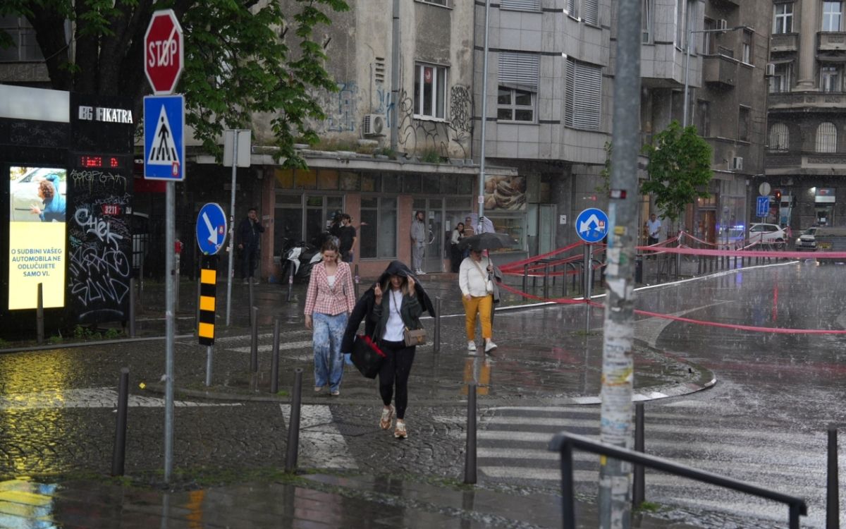
Warning for the Belgrade area due to increased precipitation (until 29.03.2026.)
Today and tomorrow it will be cloudy with rain and local showers, and in some parts of the city higher amounts of precipitation are expected—between 20 and 40 mm in the next 36 hours. A weakening of rainfall is expected tomorrow in the second part of the day.
Hydrological warning
On the Jadar, Kolubara with tributaries, the upper course of the West Morava with tributaries, the Mlava, Pek, and Crni Timok rivers, from March 28 water levels will be in significant rise, with a possibility of reaching warning levels.
Weather forecast by Nedeljko Todorović
As a reminder, meteorologist Nedeljko Todorović stated that in the coming days Serbia will receive an amount of rainfall equivalent to the average for the entire month of March, emphasizing that this is a compensation after a long dry period, but without the risk of extreme weather events.
Precipitation amounts will vary from place to place, but the total expected in the coming days corresponds to the March average, Todorović said. He noted that this is essentially a compensation after a dry period lasting from late February.
“It will vary depending on the part of Serbia. In any case, in the next few days we will get the average rainfall for March—that is essentially a compensation for the lack of precipitation. There was a dry period from late February until recently. In Belgrade, only trace amounts of rain have fallen so far,” Todorović said, adding that such weather fluctuations are normal and that dry and rainy periods alternate regardless of season.
“That is the rhythm—weather conditions are variable, and sometimes there is above-average warmth and a longer dry period, followed by a more rainy period. It goes in cycles, regardless of whether it is winter or summer—it is constantly changeable, rain then sun and so on,” he said.
Although several rainy days are ahead, Todorović emphasized that the situation is not alarming and that there are no conditions for extreme warnings that would indicate danger to life or property.
“It is possible that a yellow or orange meteorological alert will be issued, depending on precipitation amounts. There is a lot of rain now, but since it is spread over several days and across many areas of Serbia, it is not dangerous. These are not like summer storms when the entire expected rainfall falls in one hour,” Todorović said.
“An Atlantic cyclone is affecting weather conditions in the Balkans”
Weather conditions in the region are influenced by an Atlantic cyclone, which brings significant precipitation to the western Balkans, although it reaches Serbia in a weakened form. Snow has so far been recorded only in mountainous areas, while other regions will see rain along with moderate, occasionally strong northwesterly winds.
“Interestingly, the cyclone that came from the Atlantic has caused stronger and heavier precipitation in the western Balkans. By the time it reaches us, it is significantly weakened, and snow has only fallen in mountainous areas. Strong winds will affect many parts of Croatia. When it moves further, the cyclone will also affect Montenegro. In Serbia, there will be moderate and occasionally strong northwesterly wind,” Todorović said.
According to the forecast, heavier rainfall today is expected in eastern Serbia, Šumadija, Vojvodina, and parts of Belgrade. Tomorrow, rain will be more intense in western and southwestern parts of the country as the cyclone shifts.
“There will be additional cooling compared to already low temperatures. In the coming days, temperatures will generally be below average. I remind you that at the end of March and beginning of April, maximum daily temperatures are around 15–16°C. Today and tomorrow they will be a few degrees lower. Sunshine may appear, but for at least 10 days temperatures will remain lower than usual,” Todorović stated.
Snow has already been recorded in mountains above 1,000 meters, with around 10 cm falling on Kopaonik. During the night between Saturday and Sunday, further cooling is expected in western and southwestern Serbia, but without frost—only cloudy and rainy conditions.
“The cyclone is rotating and moving further, which is why tomorrow more precipitation will fall in western and southwestern parts of Serbia. Today, a little snow has already fallen above 1,000 meters, around ten centimeters on Kopaonik. I would add that during the night between Saturday and Sunday it will be colder in western and southwestern Serbia. There will be no frost, only colder, cloudy, and rainy weather,” he explained.
MORE TOPICS:
LEAKED DETAILS OF PEACE PLAN: Pakistanis reveal what Donald Trump offered to Iran!
DUE TO ALLEGED SUBVERSION OF THE STATE: Novi Pazar students remanded in custody for 30 days!
Source: Mondo, Foto: Ata images